Thursday, 16 May 2013

Hot Air Ballooning

Hey Folks,

It has been a while since you heard from us. We didn't have anything too exciting to tell you about. We were finishing up work at the dairy practice in Invercargill and were on call, so couldn't really venture too far away. The weather was quite cool and rainy much of the last two weeks down south. We pretty much stayed enclosed in our bedroom at the little place we were staying in because that was the only place with a heater...Brrrrrr...That is one thing I won't miss about NZ: the lack of insulation and heating in their houses.

Well we have now finished up work and have entered into our last month of trip. Oh how time flies. Our rough plan is to head back up north over the next weeks as we fly out from Auckland again in the first week of June to Fiji for a week and then back to the homeland. We had to readjust to van living again which only took a couple nights to get into the routine again.


Rakaia Gorge


We decided to head up the east coast of the South Island to do a hot air balloon ride over the Canterbury plains. We had heard great things and there was a deal on it so all was good.

When I woke up at 5:30 a.m. and looked out in the darkness I could see that it was quite foggy around the street lights, so I wasn't sure that our ride would be a go. But I wiped off the dry slobber on my cheek and got ready anyways. We met at the balloon pilot's house and it was still dark and foggy by the time we got there.

The pilot believed that the fog was going to rise so we headed out on a bus to our launch site. We all had a hand in helping set up the balloon for the ride. We got the basket out of the trailer and then rolled out the huge balloon.


We then used two fans to fill the balloon with cool air. As the balloon filled with air you really got an appreciation of the the immense size of it. It was quite an awesome sight with all of its colors.


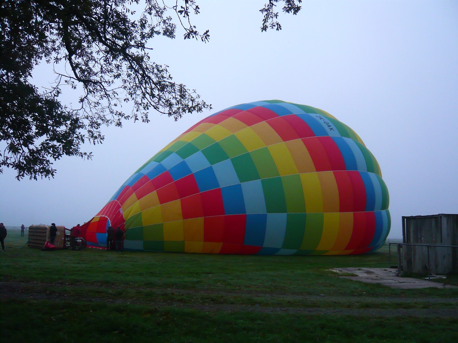


After filling it with cold air, the pilot turned on the burners to lift the balloon and tip the basket upright. It was surprising actually how little the burners had to be on for to start to lift the balloon.


It was still foggy when we were ready to take off so we just waited in the basket until we could see some blue sky. After about 20 mins we were off. It didn't take long to get above the fog and into sunny skies and then the view hit us like a freight train. There was a perfect blanket of fog with the mountains sticking up.


As we floated around we could sometimes see the ground through the fog holes, but it just wasn't lifting like the pilot thought it would and after a while we stopped seeing the holes as well.


The normal flight time was usually 1 hour, but we couldn't see the ground yet so we kept on floating. Because we were moving with the breeze, it was quite nice above the fog. We ended up staying in the air for 2 hours and 15 mins which was just fine with me. The pilots said it was the only time this had ever happened. Because of the cloud the person on the ground couldn't see us to follow us, but I showed the pilot my gps on the phone so he could tell her where to go.


We landed in a grass paddock that was 65 kms on the road from where we started! We packed up the balloon and had a traditionally champagne toast.


After arriving back at our vehicle, we decided to head into Christchurch. It is still rebuilding from the earthquake that rocked the city on Feb 22, 2011 and closed down the whole central business district. I've talked to a lot of people around New Zealand who really liked the vibe of Christchurch before the earthquake. Now, you can still feel the sadness from the loss of lives and the destruction of the earthquake. It is quite sad actually. I was feeling quite tired (and maybe a bit grumpy), so I decided to have a nap while Roberta went on a bus tour of the "Red Zone."
 Hey! Roberta here:
The Red Zone tour was very good, but also very sad. It really made me realize how dangerous it would have been if you were in the CBD that day. Here are some pics:
The Chalice sculpture


The memorial to the 185 people that died that day

A lot of areas were left exactly the way they were the day of the earthquake

The Rose window of the Chch cathedral that was smashed


That's all for now.......

Saturday, 27 April 2013

Doubtful Sound Take 2

Hi Guys,
After Queenstown we headed to Manapouri to do a day cruise out on Doubtful Sound. You may be feeling some deja-vu because Jared and his parents did an overnight cruise into this place already. Well, Jared found a deal online and we figured, "what the heck?" The place was completely different because of the rain anyways, but more on that later.

So if you remember from before, Doubtful Sound is harder to get to than Milford Sound. You need to take a ferry across Lake Manapouri and then drive a gravel road (which was very expensive to build) to Deep Cove, the terminal part of  Doubtful Sound. Here is a map to explain myself:

We started at Pearl Harbor and crossed Lake Manapouri, then drove across to the start of Doubtful Sound.

The ferry ride across was nice but there was a bit of rain so you couldn't see very far. We figured this would be awesome for the waterfalls at the fjord so we didn't fret it too much. 
Boats on Lake Manapouri 

Sun shining down on Mt. Nipple (probably not the real name)

Once on the other side of Lake Manapouri we got off the boat to tour the Manapouri Power Station. This was a very cool place and I'm not particularly into things like that. 
View of the power station from the shores of Lake Manapouri

Now it's probably ridiculous that I got the task of describing how this thing works but here goes: Lake Manapouri is 230 m above sea-level, so they dug huge channels below the ground, and as they pass the water from the lake through these and out to sea they generate power. It's not like a typical dam where they block off the flow in a horizontal direction and then generate power that way. This goes in a vertical direction. Can you dig it? Here is a schematic of the whole plant:
That yellow tube is a tunnel dug for vehicles. We drove the bus down there and were 193 m below the surface of Lake Manapouri! 
Down in the tunnel (apologize for the blurriness)

Once down there we walked into the power station machine hall, which houses the turbines. Those are the blue things you see in the picture. You only see the top 1/4 of them, the rest is below the floor, churning water like crazy or whatever turbines do. 
This picture does not do justice to the fact that this is hundreds of metres below the ground and the walls are solid carved rock. 
The whole reason this baby was build (back in the 60's no less) was for an aluminum smelter that runs down near Bluff. Apparently smelting aluminum takes a ton of power. So most of the power generated goes to that, about 15% goes onto the national grid. If they didn't have to power the smelter they could power the whole South Island easily. It was mid-blowing reading about how they first started building the tail-race tunnels (these are the tunnels that send the 'used up' water out to Doubtful Sound). All they had was dynamite, and these tunnels were 10 km long! The project took over 8 million man hours, and sadly claimed the lives of 16 men. When they wanted to build a bigger tunnel in the late 90's to increase capacity, they used a tunnelling machine (similar to the one used to dig through the English Channel). Total cost is hard to report because the 1.35 million figure from back in the '70s would be around 2 billion today. Plus the new tail-race tunnel in the 90's cost another 2 billion. Heaps!

After the power station we got drove down the gravel road that connects Lake Manapouri and Doubtful Sound. By the by, because this road was put through such rough terrain, they estimate it cost $2.50/inch of road! Along the way it was pretty misty, but here are some pics.

First of many waterfalls

The exit of the tail-race tunnel

First sight of Doubtful Sound

We hopped on a boat and hit the fjord. Yes..the early explorers misnamed all the fjords as sounds. Sounds are more V-shaped valleys (like in Marlborough Sounds at the top of the South Island). They are a flooded river valley. Fjords are U-shaped and are the result of glaciers carving out valleys. But we will forgive them, after all they did circumnavigate the Earth hundreds of years before GPS was invented. 

Some of my favourite views in Doubtful Sound were right off the bat, there were 3 peaks rising up out of the water together and were covered in waterfalls:


Because it was raining so hard, there were tons of waterfalls, all over the place. You kind of had to take cover when it really poured, and then run out and snap pictures like crazy once the rain broke. Fjordland is so magical in the rain. At this point I think it's just best to shut up and let the pictures do the talking


This is about where the clouds started to break and we were able to see the tops of the mountains again.


Getting soaked while the boat got close to the base of the waterfalls. There was so much mist!


Until Next Time!